Vatika
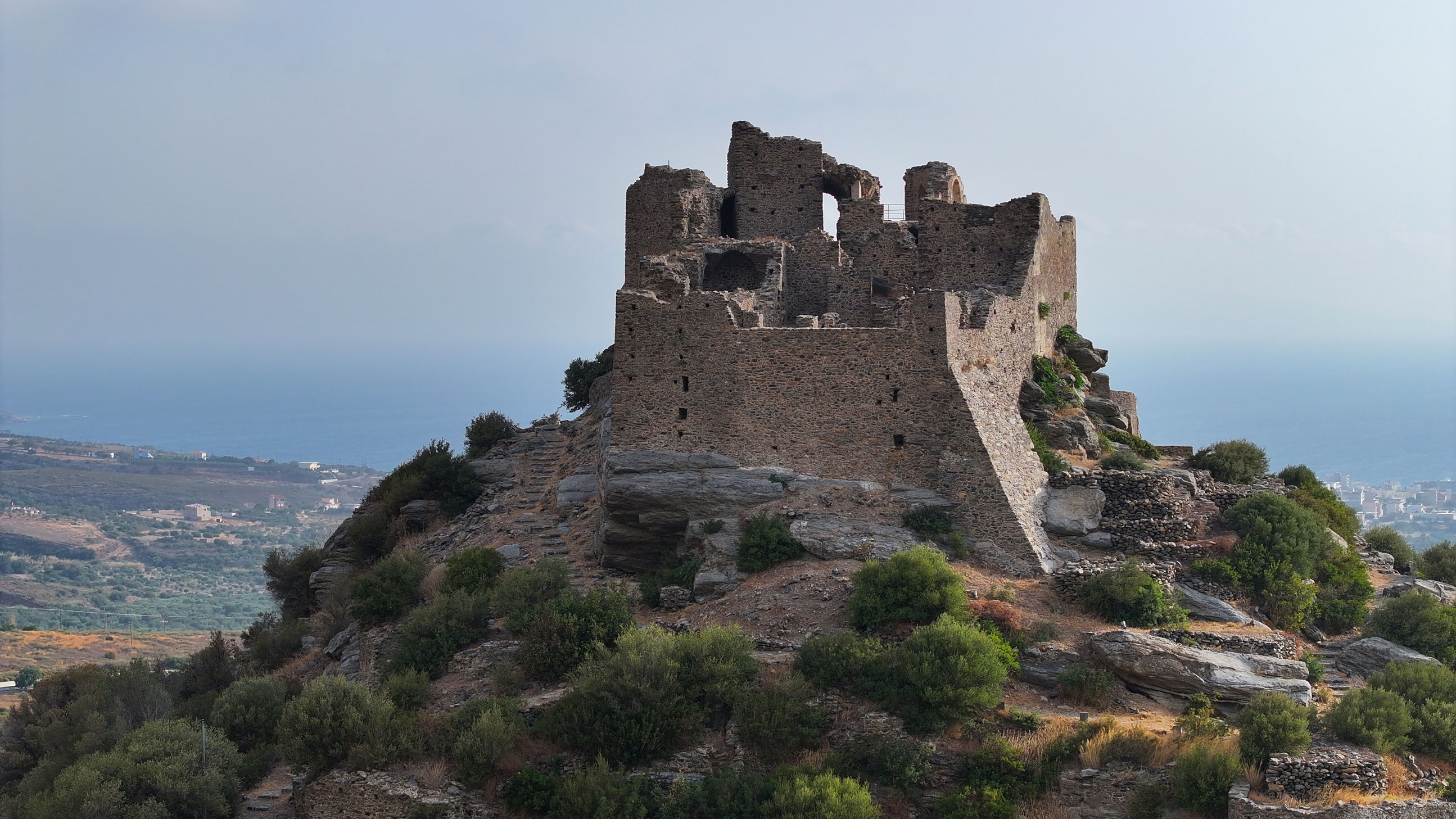
The castle is located on a rocky hilltop, a few kilometres northeast of Neapoli Voion. This naturally fortified location overlooks the Vatika Plain and the entrance to the Laconian Gulf. Due to the hill’s steep slopes, access is only possible from the northern side, where the path leading to the castle entrance begins.
The castle has retained its medieval name, first recorded in the Greek-language version of the Chronicle of the Morea. Initially built as a small, mainly military fortress, it was later remodelled to include residential buildings. Over time, a small settlement emerged around it, protected by the outer enclosure walls.
ΑΠΟ ΤΟ ΠΑΡΕΛΘΟΝ ΣΤΟ ΠΑΡΟΝ
The castle was established during the Despotate of the Morea, following the transfer to the region from the Franks to the Byzantines in 1262. In 1460, it was occupied by the Ottomans, but it soon (1463) passed to the Venetians, who seem to have carried out fortification works, such as the construction of bastions on the northern walls to adapt the castle to the use of firearms. During the Second Venetian-Οttoman War (1499–1503), the castle once again fell to the Ottomans, who controlled it until 1687. This was followed by the second period of Venetian rule until 1715, when the Ottomans recaptured the entire Peloponnese, holding it until the 1821 Greek Revolution. During the long period of Ottoman rule, no significant work seems to have been carried out on the castle, leading to its gradual abandonment and decline. Even before Greece’s liberation, the neighbouring village of Faraklo, which had become the most populous settlement in the area, was referred to as Vatika.
THE CASTLE
Only low-lying fragments of the outer enclosure walls remain, with two bastions reinforcing the northern side. The walls protected a small settlement, from which scattered buildings and the remains of a small church to the west have been found. To the north, an entrance integrated into a tower marks the beginning of the path up to the castle hill.
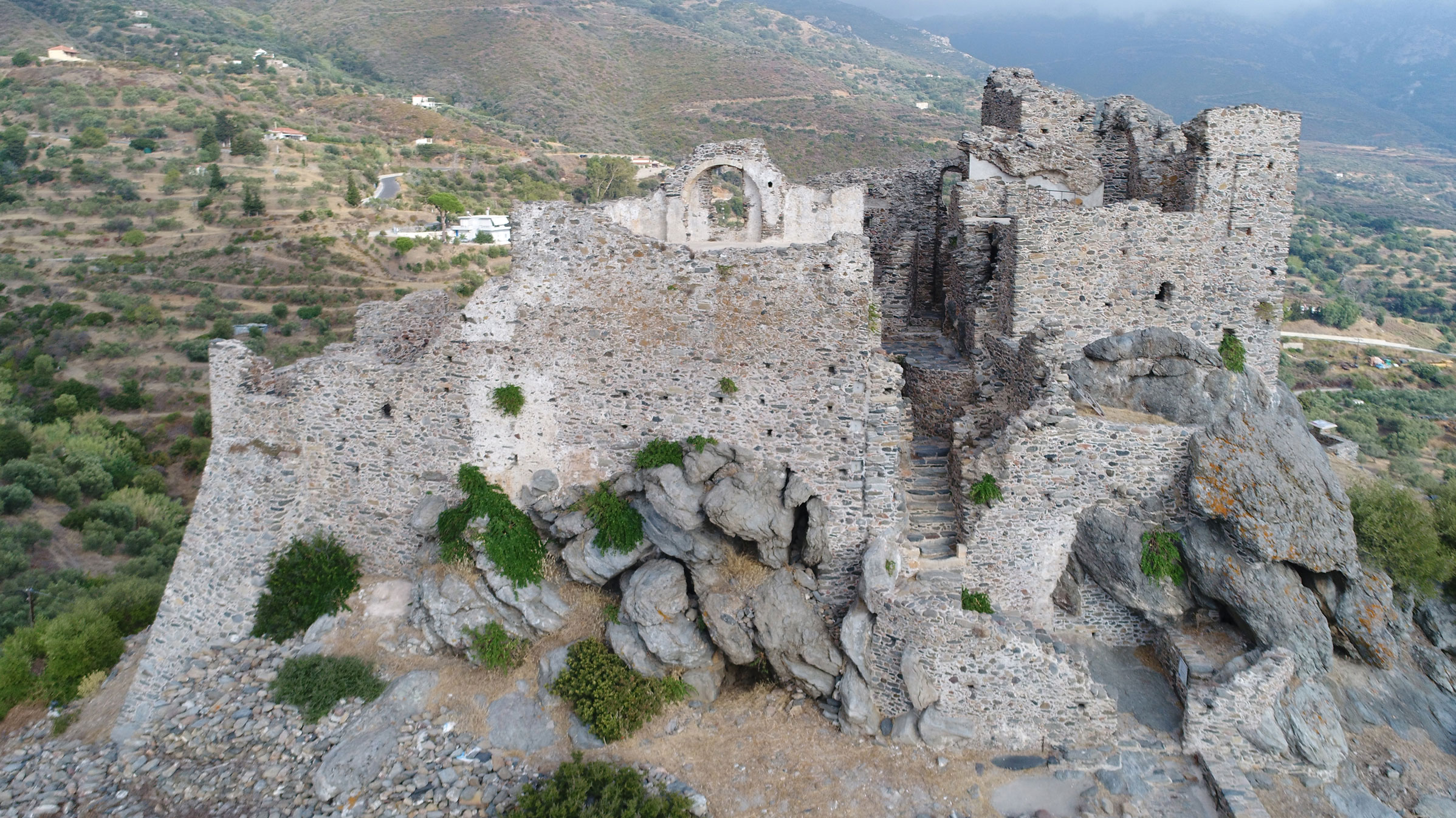
The inner enclosure is better preserved and has been restored by the Directorate of Restoration of Byzantine and Post-Byzantine Monuments of the Ministry of Culture. Its irregular shape follows the terrain. Its current form resulted from many construction phases. In the initial phase, the walls featured blind arches and had a rampart-walk, while at the highest point stood the central tower, remains of which are visible on the south side. The only entrance, consisting of two gates and a vaulted passage, opens to a building on the southwestern side, where the uphill path ended. Inside, around a small courtyard, barrel-vaulted buildings are arranged parallel to the walls. Some buildings were two-storey, and some had water collection cisterns and latrines. These structures, mainly residences, exhibit morphological characteristics very similar to those found in Mistras. On the eastern side lies the castle church, built perpendicular to the enclosure wall, with its entrance located to the south due to the terrain.