Piada
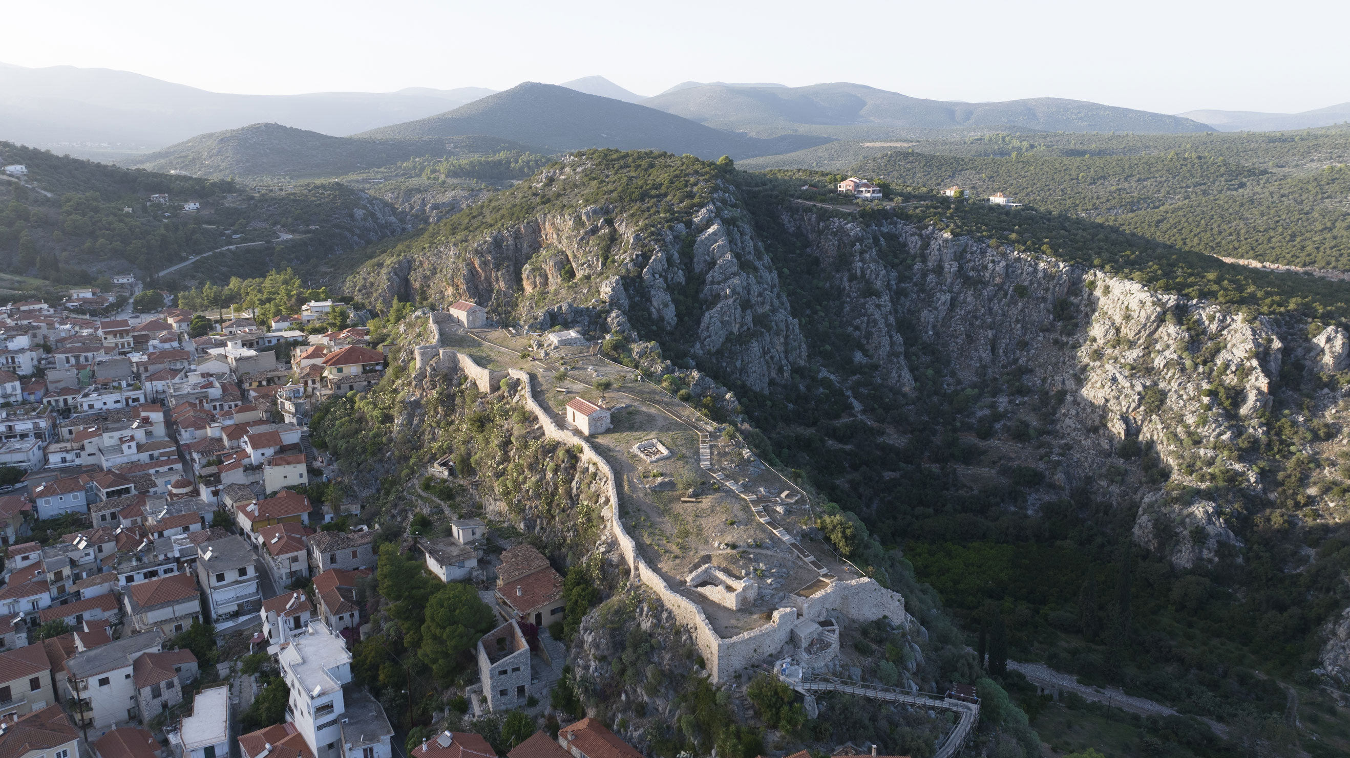
Built atop a rocky outcrop, the castle overlooks the settlement of Piada (present-day Nea Epidavros). This location, hidden from the sea, was chosen mainly to protect the settlement from pirate raids.
Variations of the name of the castle and the settlement appear in the western portolans (nautical maps) from the 14th century onwards, such as Preduia, Pedruia, Predena and Pednera, while in Greek it is given as Piada. This is where the First National Assembly took place (20 December 1821), at which the first constitution of Greece was adopted. It has been renamed Nea Epidavros since then.
ΑΠΟ ΤΟ ΠΑΡΕΛΘΟΝ ΣΤΟ ΠΑΡΟΝ
The castle is believed to have been founded during the Middle Byzantine period, though it was later remodelled under Frankish rule, acquiring its present form. After the Fourth Crusade and the occupation of the area by the Franks, Piada became part of the Castellania of Corinth. In 1272, it was granted as a fief to Nicolo Ghisi of the Venetian Ghisi family of the Archipelago. From 1342 to 1394, it was governed by the Florentine Acciaiuoli family, and after 1400, it was ceded to the Caopena family, the Catalan rulers of Aegina.
In 1460, the Castellania of Corinth fell to the Ottomans; however, Piada seems to have remained under Venetian control for a short time more, as documents dating to 1463 and 1467 refer to it as a Venetian possession. During the second period of Venetian rule (1687–1715), Grimani’s census records it under the name Pigiada.
After 1715, it was retaken by the Ottomans, remaining a significant settlement in the following centuries. It even shared a bishopric see with the settlement of Damalas. Its significance is further highlighted by the fact that the first National Assembly of the revolutionary nation took place here in 1821 in an open area, which has since been turned into a square.
The local Ephorate of Antiquities has undertaken restoration and enhancement works at the castle, including landscaped access and tour routes.
THE CASTLE
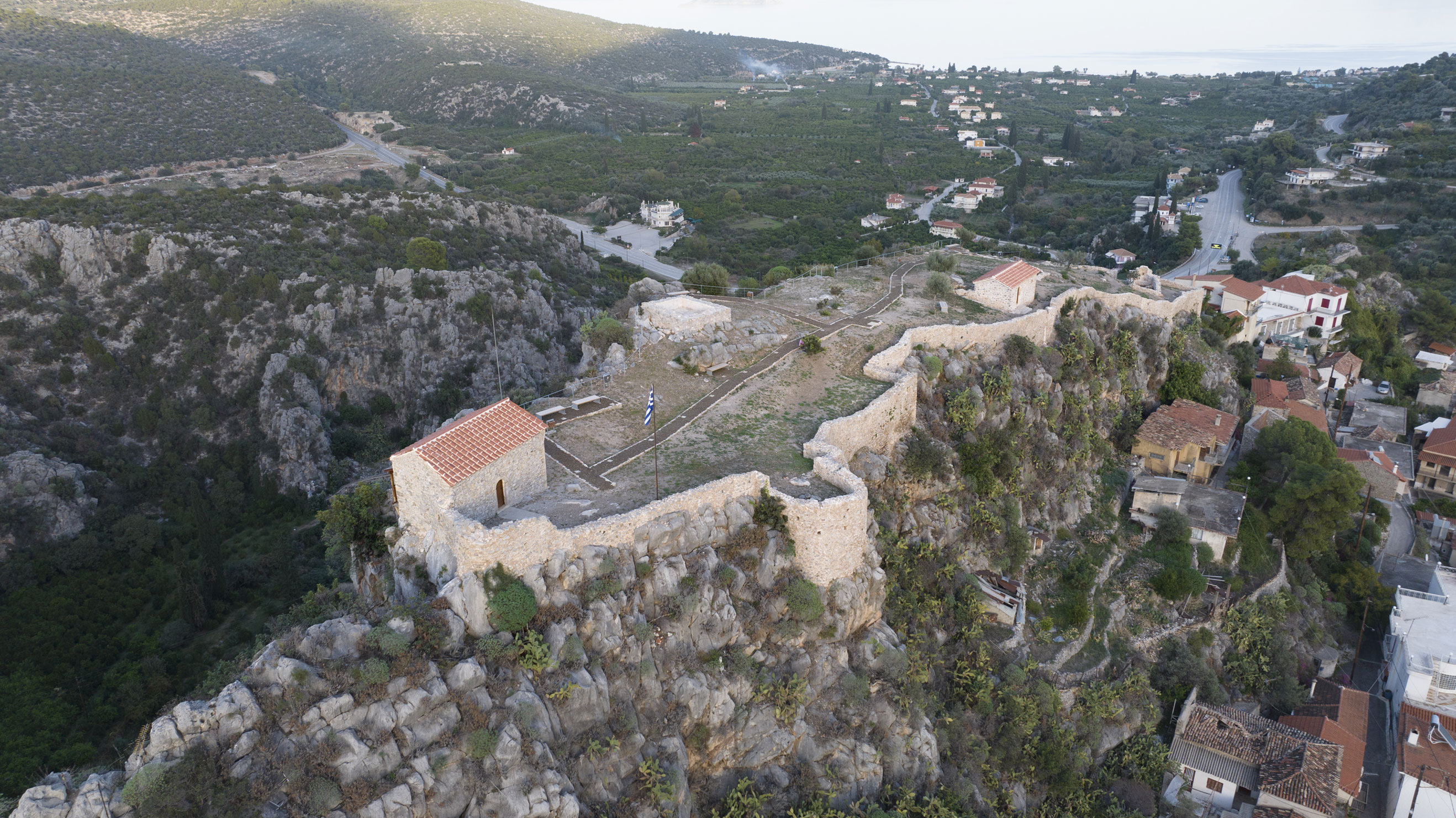
The castle, which covers an area of 0.3 hectares, features an irregular longitudinal ground plan, following the rock’s natural ridge along an east–west axis. Its walls extend along the southern, western and eastern sides of the hill, while the north is unfortified, as it is entirely inaccessible due to the steep sides of the Vothylas ravine. The remnants of several towers are still visible, mainly on the southern side, which was the largest and was reinforced with a U-shaped bastion and two towers, whose remains can also be seen.
At the highest point of the castle in the northwest, the remains of the central tower of the Frankish castle, which stood until the early 19th century, are preserved. This quadrangular tower had an elevated entrance, likely accessed by a movable staircase. The floor of its lower part, which belonged to a cistern, is visible.
The entrance to the castle, located on the eastern side, is accessed today from the village along a paved path.
THE INTERIOR
Few remains survive inside the castle, as the ruins of its buildings were repurposed as construction material for structures in the settlement.
The aisleless church of Agios Ioannis Theologos is preserved in good condition at the western end of the castle. According to a dedicatory inscription, it was decorated with wall paintings in 1710, while it preserves an immured relief slab of the Middle Byzantine period, later engraved with the date 1708.
The remains of two more aisleless churches, one on the eastern side near the gate and one further west, dating to the late Late Byzantine or early post-Byzantine period, are also preserved.