Igoumenitsa
Built on a low, pine-covered hill at the southwest part of the modern city, Igoumenitsa Castle commands and protects its harbour. The hill’s first fortifications were probably erected in the Roman period (2nd c.), associated with the establishment of a settlement in the Ladochori area, south of the present castle. Both the settlement and the castle-citadel were abandoned in the late 6th century. The name of the Roman settlement remains unknown. The current name, Igoumenitsa, appears in written sources from the 14th century, while the Portum Gomisso anchorage near the Kalamas River is noted in Italian nautical maps as early as the 12th century.
ΑΠΟ ΤΟ ΠΑΡΕΛΘΟΝ ΣΤΟ ΠΑΡΟΝ
The castle is linked to the Venetians and the commercial outpost they maintained in the 15th century at Igoumenitsa harbour (Porto delle Gomenizze), similar to other coastal sites in Epirus. In 1479, following the First Venetian-Ottoman War, the area was ceded to the Ottomans by treaty, but it remained a contested region until 1540 and the end of the Third Venetian-Turkish War. In the 16th century, before and after the naval Battle of Nafpaktos in 1571, the Christian fleet used Igoumenitsa harbour as a station.
The start of the Seventh Venetian-Ottoman War resulted in the most significant recorded destruction of the fortress in wartime. In 1685, it was abandoned by its inhabitants and the Ottoman garrison, then occupied by the Venetian admiral Francesco Morosini. Deemed defensively weak and unaffordable to repair, it was partially destroyed while its cannons were transported to Corfu.
The fortress remained half-destroyed until 1798, when Ali Pasha of Ioannina took control of it and some repairs were carried out. After that, the monument fell into obscurity. After World War II, the hill was planted with trees, and a water reservoir was constructed in the northern part of the castle to serve the needs of the modern city and the harbour.
THE CASTLE
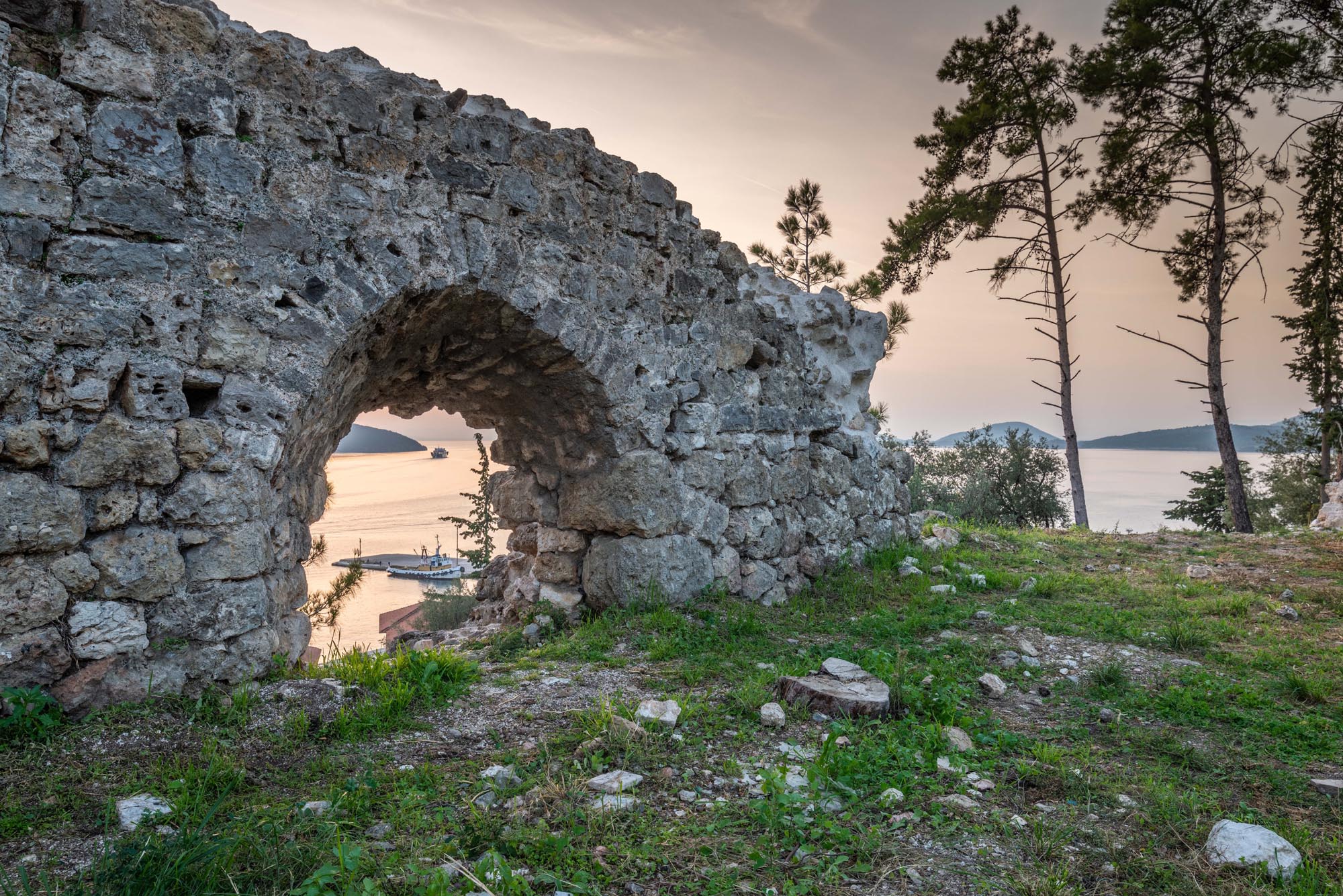
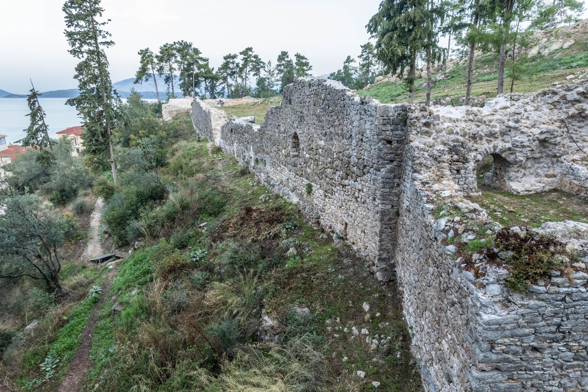
Today, Igoumenitsa Castle is partially preserved, with a trapezoidal ground plan covering about 0.6 hectares. The southern side of the fortification, facing the harbour, is the best preserved. The walls contain arched cannon embrasures for the protection of the natural anchorage offered by the bay. Square towers reinforced the perimeter of the fortification, with only one remaining in the southern wall, still preserving its vaulting.
Traces of the main entrance to the castle have been discovered in the centre of the eastern walls. The gate was flanked by two towers, reinforcing its protection.
In the northeastern corner, a cross-wall formed an inner citadel. The gate leading to the citadel seems to have been located in the centre of the cross-wall, which is now mostly ruinous.
Seventeenth-century engravings depict buildings inside the castle, including residences, a church and a mosque. Today, only fragmentary remains of walls and cobblestone floors survive from these structures. An exception is a ruined rectangular building, identified as a gunpowder storeroom, abutting the northwest corner of the wall. The modern water reservoir is located in the northern part of the castle, on the citadel.
The local Ephorate of Antiquities has carried out enhancement works at the castle.