Arta
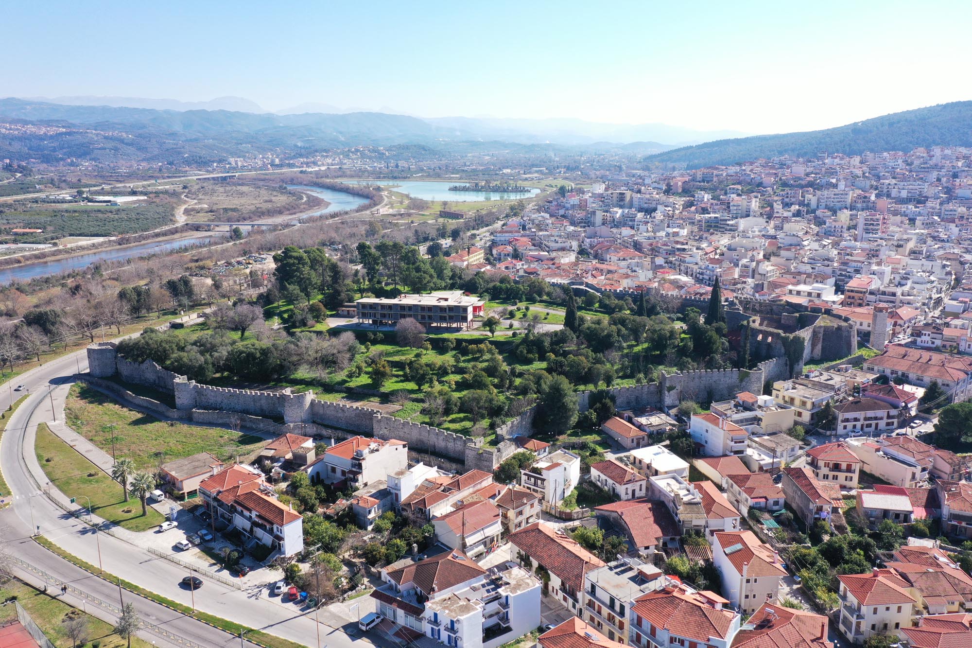
Arta Castle stands on a small hill in the northeastern part of the modern city. It occupied a naturally fortified site, as during its construction (11th–12th c.), the River Arachthos protected its eastern and northern flanks. Today, alluvial deposits have shifted the riverbed far from the walls. The location of the castle was of particular strategic significance, as it commanded a key route to the hinterland of Epirus. The Arachthos, navigable up to its mouth in the Ambracian Gulf, provided Arta with access to sea trade routes.
ΑΠΟ ΤΟ ΠΑΡΕΛΘΟΝ ΣΤΟ ΠΑΡΟΝ
The strategic importance of the city has been recognised since antiquity. In the late 7th century BC, Corinthian colonists founded Ambracia, a significant political, economic and commercial centre in northwestern Greece, on the site of the modern city. In the early centuries of the current era, Ambracia declined, leaving no historical traces. It reappeared in historical sources in the 11th century under a new name, Arta. The construction of the castle, which incorporated parts of the defensive wall of Ambracia on its eastern and northern sides, dates to this period.
After the fall of Constantinople to the Crusaders in 1204 and the dissolution of the Byzantine Empire, Michael I Komnenos Doukas established in 1205 the independent state of Epirus, widely known today as the Despotate of Epirus, designating Arta as its capital. The repair and reinforcement works on the castle, which gave it the form it retains to this day, are attributed to his son, Michael II. Preserved Byzantine monuments outside the castle, within the fabric of the modern city and in the wider area, attest to Arta’s development into a thriving urban centre during this period.
The 14th century, especially after 1318, was a period of intense political turmoil. The castle and the city were besieged by the troops of King of Charles II of Naples, the Byzantine Emperor Andronikos II Palaiologos as well as Serbian and Albanian local leaders. Control of the despotate, as well as Arta, passed through the counts of Kefalonia, Byzantine Emperor Andronikos III Palaiologos and, finally, Serbian Tsar Stefan Dušan. After 1374, Arta came under the rule of the Albanian Shpata family. In 1416, Charles I Tocco, count palatine of Zakynthos and Kefalonia, who had already occupied Ioannina, also captured Arta and became ruler of Epirus. From 1430 onwards, the city paid tribute to the Ottomans, who definitively conquered it in 1449.
During the period of Ottoman rule, Arta remained an important and prosperous regional centre. Between 1796 and 1820, it was part of the pashalik of Ali Pasha, who carried out extensive repairs on the castle and likely constructed the southwestern bastion. Inside the citadel, there was a prison where Makrygiannis and other revolutionary fighters were imprisoned. During the Greek Revolution of 1821, despite the efforts of Greek forces, the castle remained under Ottoman control. In 1881, following the Treaty of Constantinople, Arta was incorporated into the Greek state. The prison, by then located in a separate building, remained in operation until the mid-20th century, when the castle was transferred to the Hellenic Tourism Organisation (EOT). In 1960, EOT completed the construction of the Xenia hotel and the landscaping of its surroundings, featuring gardens and extensive tree planting. The local Ephorate of Antiquities has carried out consolidation, restoration and enhancement works on the castle.
THE CASTLE
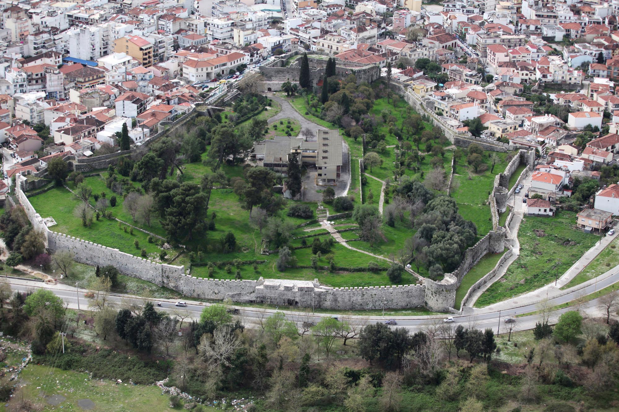
Arta Castle features a trapezoidal ground plan and covers approximately 4 hectares. Its small size contrasts with the importance that Arta gained after the 13th century. The castle likely formed part of the city’s broader fortification system, serving as a fortress complex and the seat of both civil and military administration. It has been suggested that the ancient defensive wall, which stretched 4.5 km in length, may, with the appropriate interventions, have enclosed the medieval city as part of a larger defensive perimeter. This hypothesis, however, awaits confirmation through archaeological excavation.
Today, the castle walls reach a height of 11 m in some places and are reinforced in key points with rectangular, semicircular, polygonal and triangular false towers (triangular projections of the walls). During the city’s historical trajectory, the walls were repaired and modified . A rampart-walk runs the entire length of the wall. Later, the Ottomans added cannon embrasures and gun slits to the battlements and widened the rampart-walk where necessary. Localised interventions were generally made to accommodate the evolving demands of firearm technology.
The eastern side of the castle has the fewest towers, as it was naturally protected by the Arachthos River. A bulwark, a lower defensive wall located in front of the main enclosure, reinforced the defence and protected the fortification from river flooding. It is better preserved on the northern side and survives in fragments on the eastern side.
The southwestern corner of the castle, although not the highest point, is enclosed by an interior wall that separates it from the rest of the complex, forming a heavily fortified citadel known as Iç Kale or Kastraki. In the early 19th century, the citadel was reinforced with a strong polygonal bastion suitable for the placement of firearms.
THE GATES
The main gate of the castle, located on the southern side of the walls, currently serves as the only access point to the site. Its present form is the result of modern modifications. It was protected by a square tower and an external bulwark. A smaller postern gate was located on the northern side of the walls, next to the Arachthos.
Very close to the castle’s central gate is the entrance to the citadel, which was protected by a bulwark. A gate in the bulwark leads through an oblong corridor to the low entrance to the citadel itself. The citadel gate has a marble doorframe, likely made from reused architectural members, and was protected by a machicolation, that is, a built-in enclosed protrusion with floor openings through which defenders could fire on attackers.
THE CITADEL
Inside the citadel, the northern side of the site is occupied by a large building that has been restored and now serves as a temporary exhibition space. While its current form dates to the Ottoman period, the structure incorporates elements from earlier construction phases. Above its arched entrance is an immured marble relief of the Byzantine period depicting a lion. Another smaller building is preserved on the southwestern side of the site. Near the bastion, towards the southwestern corner, stands a marble, rectangular mouth of a well, which bears the coat of arms of Count Charles I Tocco of Kefalonia, who ruled Arta after 1416. In the courtyard of the citadel, a small, modern outdoor theatre has been constructed. Below the theatre lie the remains of a ruined Byzantine-period building.
THE INTERIOR
The Xenia hotel, which dominates the castle’s interior, is situated near the modern church of Agioi Pantes (All Saints), built on the site of an earlier church. The architectural remains of a large building, dated to the Byzantine period, are also distinct. It has been suggested that this building could be the palace of the rulers of the Despotate of Epirus, as well as the saray in which the garrison commander resided, mentioned by the 17th-century traveller Evliya Çelebi. The rest of the area around the modern hotel has been landscaped into a garden, featuring dense tree plantings, walking paths and sports facilities.