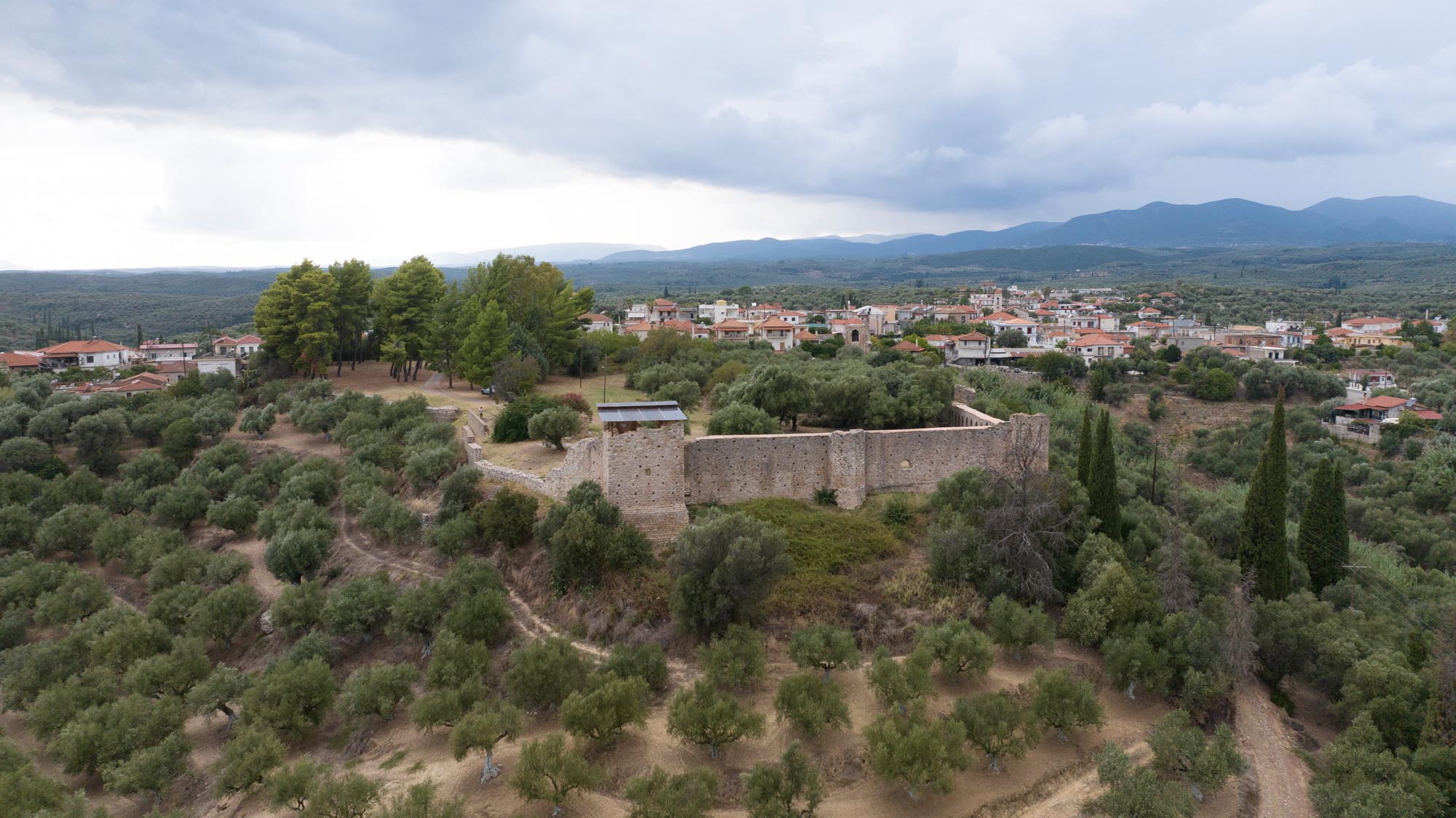
Androusa
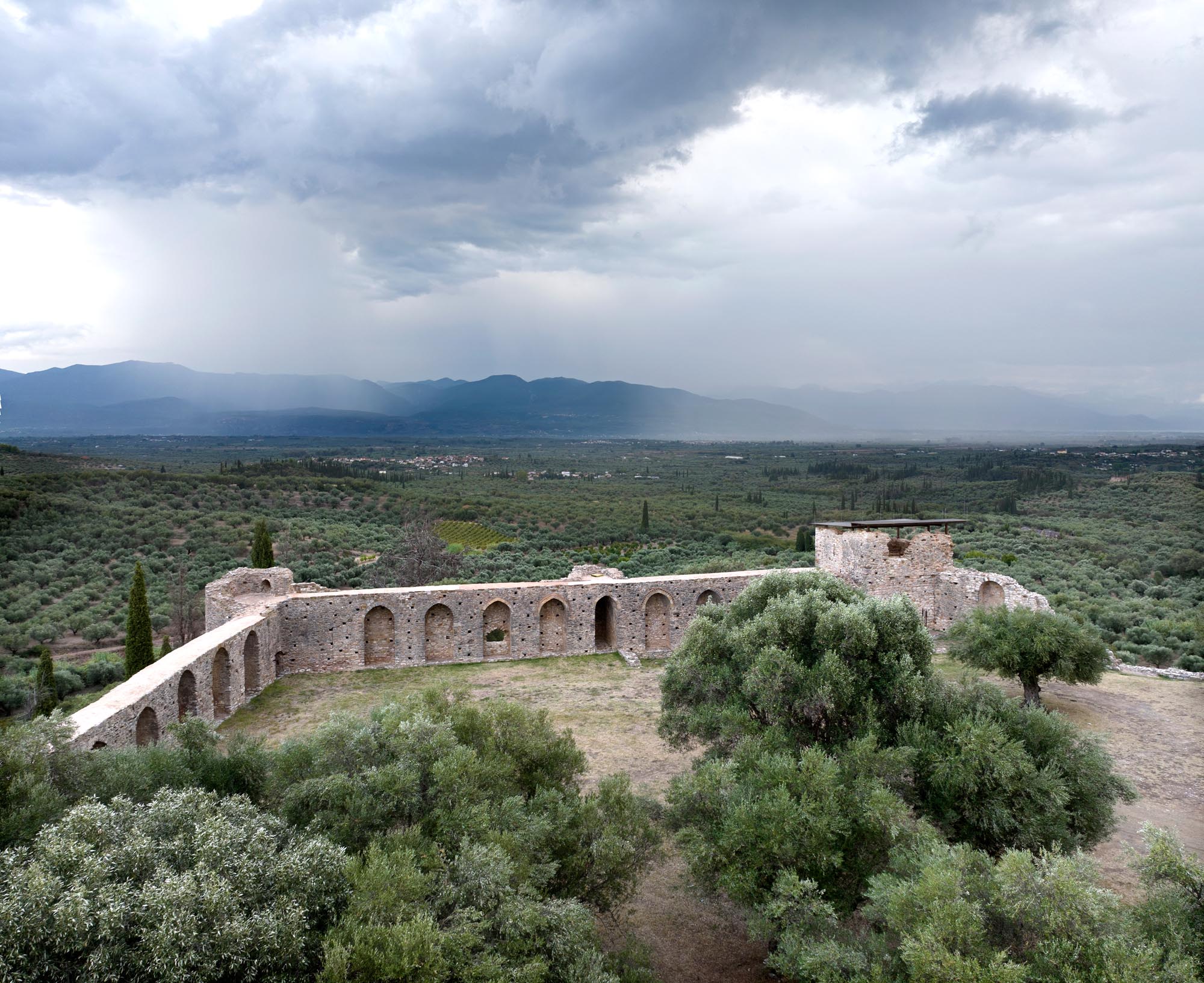
The walls of Androusa Castle rise between the olive groves on the western edge of the Messenian Plain. Today, only a portion of the castle remains on the low, flat hill east of the modern settlement of Androusa. While the site lacks natural fortifications, it provides a commanding view and control of the fertile plain of southern Messenia.
ΑΠΟ ΤΟ ΠΑΡΕΛΘΟΝ ΣΤΟ ΠΑΡΟΝ
According to the Chronicle of the Morea, a 14th-century account of the conquest of the Peloponnese by the Frankish knights of the Fourth Crusade, the castle was built in the mid-13th century by William of Villehardouin, prince of Achaia. Androusa is also served as the seat of the capitaneus (governor) of the Castellania of Kalamata. Apart from Androusa, there were capitanei with the right to administer justice only in Glarentza, the most important harbour of the Frankish Principality of Achaia.
The proximity of Androusa to the borders of the Venetian territories in southern Messenia, combined with the gradual strengthening and expansion of the Byzantine possessions in neighbouring Laconia, reinforced its strategic importance. The castle flourished during the 14th century, at the end of which it was the seat of the mercenary Navarrese Company, which occupied it in 1381. A year later, a treaty of good neighbourliness with the Venetians was signed in Androusa. At the beginning of the 15th century, it passed to the Despotate of the Morea and then to the Ottomans. In the second half of the 15th century, Androusa, like the rest of the Peloponnese, was a contested space between the Ottomans and Venetians. In 1533, it served as the Ottoman camp during the occupation of Koroni by the Genoese admiral Andrea Doria.
In the following centuries, Androusa was a vital regional centre, with a predominantly Muslim population. During the second period of Venetian rule (1685–1715) of the Peloponnese, it served as the seat of an administrative division (Territorio di Androussa) of the Venetian Kingdom of the Morea. However, its castle lost all strategic significance, as evidenced by the lack of any reference to it in Venetian records.
THE CASTLE
The castle had a trapezoidal ground plan, with its walls following the terrain and enclosing an area of about 2 hectares. The eastern, southern and northeastern parts of the fortification enclosure remain intact. Of the western wall, only one tower survives, now situated among modern residences. All the surviving structures have been restored by the Ephorate of Antiquities of Messenia.
A distinctive feature of Androusa’s walls are the series of pointed blind arches of well-dressed masonry supporting the rampart-walk. The method of supporting the rampart-walk with blind arches was a common feature of Greek fortifications since antiquity, with numerous examples after the 13th century. In the eastern wall, bands of decorative bricks adorn the arches, a rare element in forts of this scale. The castle walls were further reinforced by towers, which connected with the rampart-walks through arched openings on their upper floors. The ground floors contained rooms with saucer-domed ceilings.
The large four-sided tower in the southeastern corner of the castle stands out due to its size and form, as it included living infrastructure (a cistern on the ground floor, and a latrine, fireplace and open cistern on the upper floor). It served as a keep or donjon, a castle’s highest and strongest tower and the last line of defence in the event of an attack.
The southeastern tower is the oldest fortification structure. The walls and other towers were added later. The northern wall seems to have been rebuilt around 1400 to adapt to the needs of the new defensive technology of firearms, as the early, small cannon embrasures in its towers indicate.
Androusa Castle functioned as a fortified settlement, as indicated by its size, flat terrain and design. No visible remnants of the settlement survive. The only ruined building within the castle dates to the 20th century.