Agionori
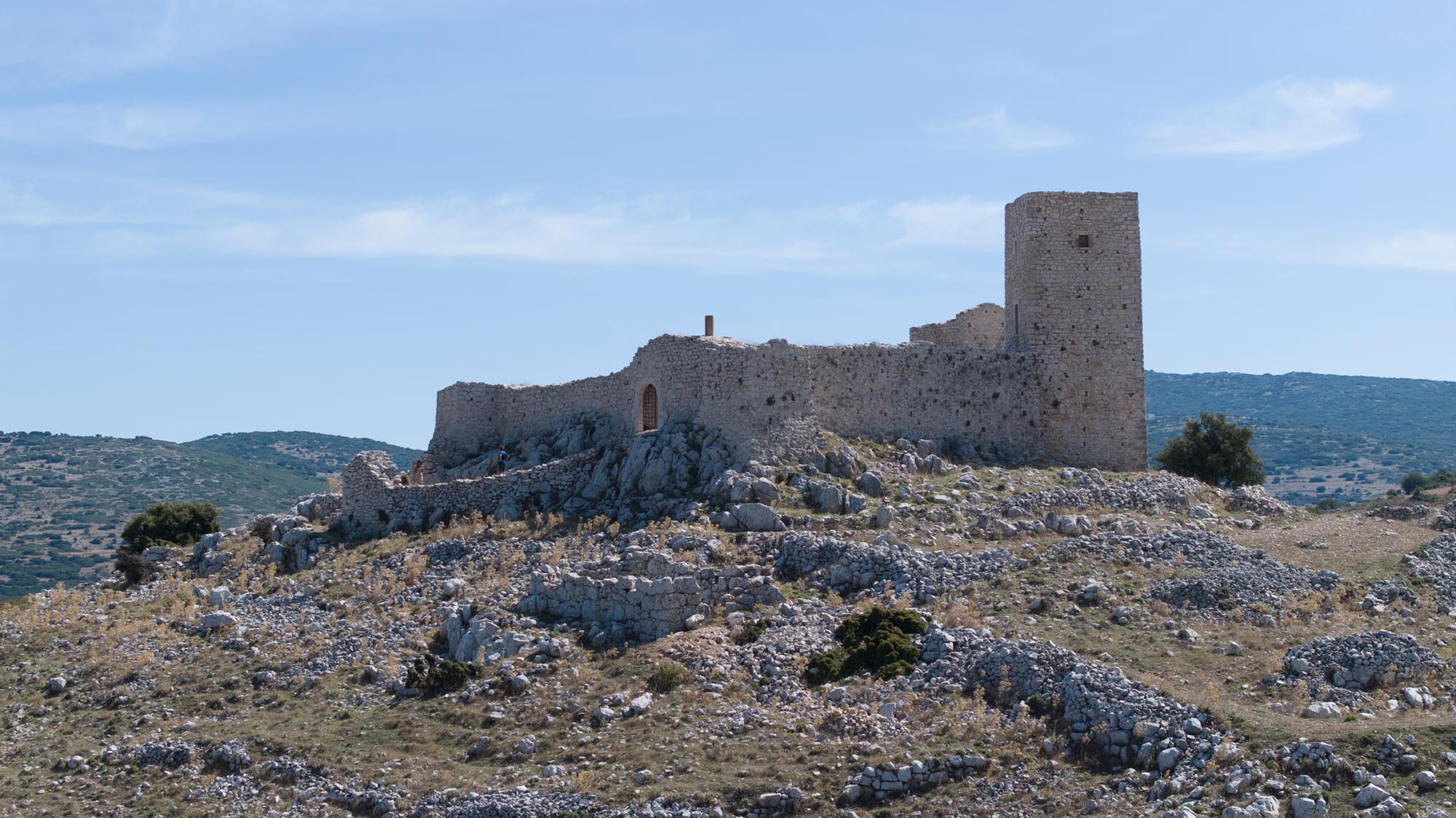
Built on a hill north of Mount Arachnaio, Agionori Castle occupies a strategic location on the Kontoporeia road, one of the main routes connecting Corinthia with the Argolid. Its name appears to derive from the adjacent significant Byzantine settlement of Enorion, referenced in the 10th-century Life of Nikon the Metanoeite. In later historical records, including the Chronicle of the Morea, it is referred to as Agion Oros (Holy Mountain), probably due to the number of its churches, with variations of the name appearing in other written sources.
ΑΠΟ ΤΟ ΠΑΡΕΛΘΟΝ ΣΤΟ ΠΑΡΟΝ
In the wider area of the castle, traces of habitation date back to antiquity. During the Byzantine and Late Byzantine periods the settlement was one of the most important in the area. Based on its construction and morphological elements, as well as historical data, the castle is believed to have been built during the Frankish period, by the 13th century, and it is explicitly mentioned for the first time in written sources in 1450. A settlement developed outside its walls and it is notable for its numerous small, mainly aisleless churches of the Late Byzantine period, now in ruins. The transverse-vault church of Agioi Anargyroi, which contains wall paintings dating to 1325/26, according to an inscription preserved on the apse of its sanctuary, remains intact.
From the 13th century, following the partition of the Byzantine Empire after sack of Constantinople by the Crusaders (1204), Agionori became part of the Frankish Principality of Achaia. By the mid-14th century, it had passed to the Florentine Acciaiuoli family. In 1460, the Ottomans seized the castle, retaining it for about two centuries. Like the rest of the Peloponnese, it was under Venetian control from 1686 until 1715, when the Ottomans reclaimed it. The castle played an important role during the Greek Revolution of 1821, when Nikitaras used it as a base for his campaign against Dramalis (1822).
The local Ephorate of Antiquities has undertaken restoration and enhancement works at the castle, including landscaped access and tour routes.
THE CASTLE
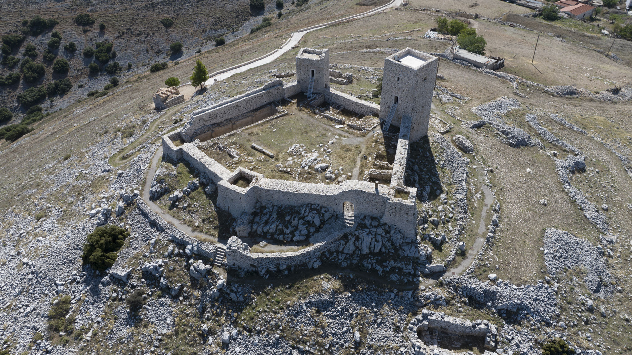
The castle is small, featuring a pentagonal ground plan with rectangular towers in the corners. Archaeological research indicates that its construction progressed in phases during the Frankish period. Initially, two tall towers, which also served as accommodation and storage areas, were erected on the southern side, the castle’s most vulnerable. The three-storey one in the southwestern corner, which had a storage room or cistern on the lower level and living quarters on the upper floors, was the castle’s main tower. The southeastern tower included a chapel, whose apse was embedded in the eastern wall. Subsequently, the enclosure and the other three towers to the north were completed, followed by the construction of the buildings around the courtyard, including administrative buildings, residences and storage facilities. The castle walls feature a rampart-walk, at a height of about 5 m, allowing for the movement of the garrison, crenelations, of which few traces remain, and arrow slits for defence.
The sole entrance is located in the most inaccessible part of the castle, on the northern side. It lies beneath the enlarged middle tower, reinforced by a small outer fortification enclosure (barbican).
Today, within the fortress, only the ruins of buildings around the courtyard and abutting the perimeter walls remain. On the northern side, two buildings are visible, the largest of which has an underground cistern.